This was supposed to be a "father/son" bonding experience, but the "son" component dropped out at the last moment. In hindsight, probably not a bad thing.
I am admittedly a fair weather walker and tend to bail out when it looks like rain, but with my holidays ending up and a new job approaching I was aching to get out. Rain was definitely going to happen according to all reports so I just had to harden up. I wasn't 100% sure about the wisdom of tackling Gladstone Pass in the wet, but in the end thought "bugger it" and head off anyway. Packed the heavy rain jacket and strapped on my most destroyed pair of shoes and was off.
Off course I had to stop at Mountain High Pies at Wentworth Falls to buy dinner. I should have a sponsorship by now. Pies loaded in the trusty cold bag, it was adventure time.
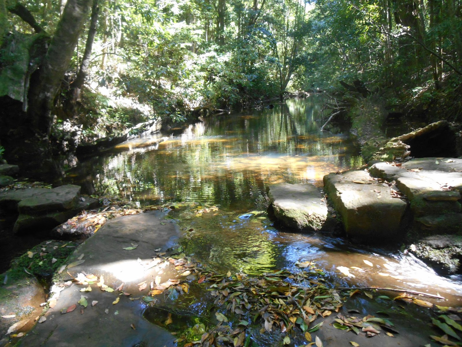
I have tackled Gladstone Pass before ( January 2015 ), but it was a lovely warm summer's day back then. The track down had been obscure and challenging enough that day, but not a problem. Heat and humidity were the challenges that day. This time it was bucketing down, and the Pass was a maze of small water courses, with lots of sludgy mud patches and slippery bits. For the first time ever I wished I actually had a pair of sturdier walking shoes (and I was on leech alert the whole time, but didn't see a single one). Lots of trees down that made for quite a few scrambles. This Pass is not for the inexperienced walker after a nice stroll.
It was much darker than last time. Heavy cloud cover and torrential rain made for a very dark and gloomy place. Normally the tree canopy keeps out most of the wet, but today the trees were so loaded with water it was getting through in buckets, making it even trickier than last time to keep on the track. More than a few times I stood with water running over my shoes, and water pouring down, looking for a sign of "where next"? Occasional aluminum markers on trees were handy. Someone with big boots had gone through recently, so thank you to that person who left big footprint puddles in several convenient locations. Glad I'm not the only crazy person out in the wilds. Also glad I didn't drag #1 son down here today. I may have ended his walking days. Especially when hanging off the rope line following the narrow ledge with a somewhat hair raising drop drop below. Again, this Pass is not for the inexperienced walker after a nice stroll.
At some point I began thinking about where the left turn to Roberts Pass would be. Last time along here I had not seen it, and couldn't even think where it might be It was too wet to drag out the maps, but I knew that if I arrived at Dash's Cave that I had gone too far. Sure enough, I duly arrived at Dash's Cave. At least it was a chance to get out of the rain, eat, make an entry in the log book, and puzzle over the map. After a while I realized that even if I couldn't see the turn off, that I could puzzle it out from the land form. Gearing up again, I back tracked to where I knew it must be. It seems I may be blind, because at the point where I was thinking "it must be here" I noticed two small cairns (not one, but two for the dummies) and two yellow markers (too make it unmissable to all but the completely hopeless) that I had clearly walked right past earlier (about 8.55 in the first video below). As I wandered over to look closer I could suddenly see the track disappearing off away on the other side of the creek. It takes me a while, but I get there eventually.
The track along to Roberts Pass was a breeze. The main problem being that I was wearing a pair of my son's old soccer shorts from High School that had little elastic left. They were saturated and kept falling down. I went off track for a while to look for the old coal mine. I found it eventually and it gave me the creeps. I cannot imagine in my wildest dreams (nightmares) just what it would have been like to come down here and work in that small space.
Back on the track to Roberts, the huge banks of fog would occasionally clear. Mount Solitary would appear occasionally like some huge ghost ship, then disappear again. It looked close enough to touch. The turn off up to Roberts Pass was clearly marked, and the metal stairs through the rock were an experience. At the top I went out to Gladstone Lookout, and the cliff line was awesome. Fingers of fog creeping up through cracks in the cliff line. As I watched, a huge bank off fog slowly rose up blanketing everything. There wasn't a sound to be heard. The huge drop I was standing next too suddenly looked like a rug you could walk along. An awesome moment.
The walk back to the car was a sloshy splash. Arriving at the car I had to decide a course of events that would see me changed, vaguely dry, and not arrested for exposing myself in public. Eventually I managed some half arsed nude yoga in the car. I did discover that I had spare socks but no dry shoes, so I eventually ended up wandering Leura bare foot looking like a homeless man as I popped into Megalong Books. Grabbed a couple more history/ walking books and it was a day well done.
I managed to play with the video on my camera whilst trying not to trash it in the rain. The "father/son" bonding experience occurred as he patiently tried to explain to Retro Daddy how to link avi clips. Such a patient lad. If you have the patience, my dodgy efforts are below. The first one covers the wondrous Gladstone Pass.
Gladstone Pass to Roberts Pass part 1
Gladstone Pass to Roberts Pass part 2
Gladstone Pass to Roberts Pass part 3